

I have to go back to Mt. Davis?

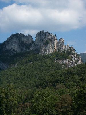

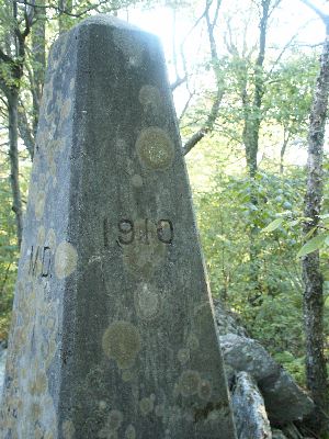
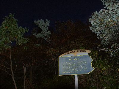
BEDFORD, PA - Pictured above are, from the top:
- the view from Spruce Knob, the highest point in West Virginia
- Seneca Rocks, WV
- the smallest church in the U.S., near Silver Lake, MD
- the WV/MD border marker near the highest point in Maryland, Backbone Mountain
- Mt. Davis, the highest point in PA.
I dawdled a good bit in WV, so I didn't get to Mt. Davis until it was turning dark, and it was night by the time I got to the top. Unfortunately, I didn't find the absolute highest point, which, according to a gas station attendant, is on the top of a 6' high rock. Of course, I asked where it was after I got down. So, while I walked around the observation tower a bit, I might not have got the actual highpoint. It was pretty dark up there after all.
I'll have a more detailed trip report later, including commenbts on West Virginia, but while I'm thinking about it, the coordinates of the parking area for Backbone Mountain are approximately 39N 14' 49.1" by 79W 29' 33.6". The starting elevation is about 2730', making the actual hike up about 650' of elevation gain and not 750'. If, of course, my GPS was accurate.